
Birdi vs Nearmap
Visualise your sites and assets easily, with up-to-date, high resolution imagery captured by drones.
.png)
Why choose Birdi instead of Nearmap?
Nearmap captures aerial imagery via flying manned aircraft across regions of Australia. They capture 1-6 times per year, focusing mainly on urban areas with less-frequent regional capture. If your site location falls outside of their capture areas, Nearmap isn't going to meet your aerial data needs.
With Birdi, you don't need to wait until a manned aircraft has its scheduled flight. Fly your own drones or we can fly for you, on demand, and visualise your drone-captured data directly within the Birdi platform right away.
What's more, drones provide greater resolution than manned aircraft - less than 3cm/pixel compared to 5-10cm/pixel - which means the data you can visualise and draw insights from is of a higher quality and accuracy. This is particularly important when you need detailed visibility, like when inspecting assets or structural damage to a site. These high resolution images are overlayed on the map, or processed into their own map, at the exact position they were captured, so you have real, contextual understanding of your site directly within the Birdi platform.
Choose Birdi because:
.png)
.png)
Higher resolution imagery
Drones can capture at a higher resolution and accuracy than manned aircraft, giving you greater site-wide visibility as well as the ability to zoom in and inspect every image. Ideal for individual assets and sites.

Own your own data
With Birdi, you own your drone data, even if our pilot network captures it for you. You can share it, download it, annotate it and more, because it’s 100% your own.
Some Birdi customers

.png)
.png)
.png)
.png)
Choose Nearmap if:
You need a quick scan or simple visibility over very large areas
Nearmap's manned aircraft capture is of macro areas like whole suburbs, whereas drone coverage is more at the targeted, micro level. If you need aerial oversight over really large areas with lower detail, Nearmap could be for you.
You need very occasional/infrequent visibility of sites
Maybe you just need oversight of a general area at the odd time or two throughout the year, and up-to-date oversight isn’t critical for you. If so, Nearmap could do the trick.
High resolution imagery isn’t important
If you don’t need high resolution aerial imagery, then Nearmap could work for you.
Otherwise, choose Birdi.
We think you’re gonna love us!
What you can do with Birdi:
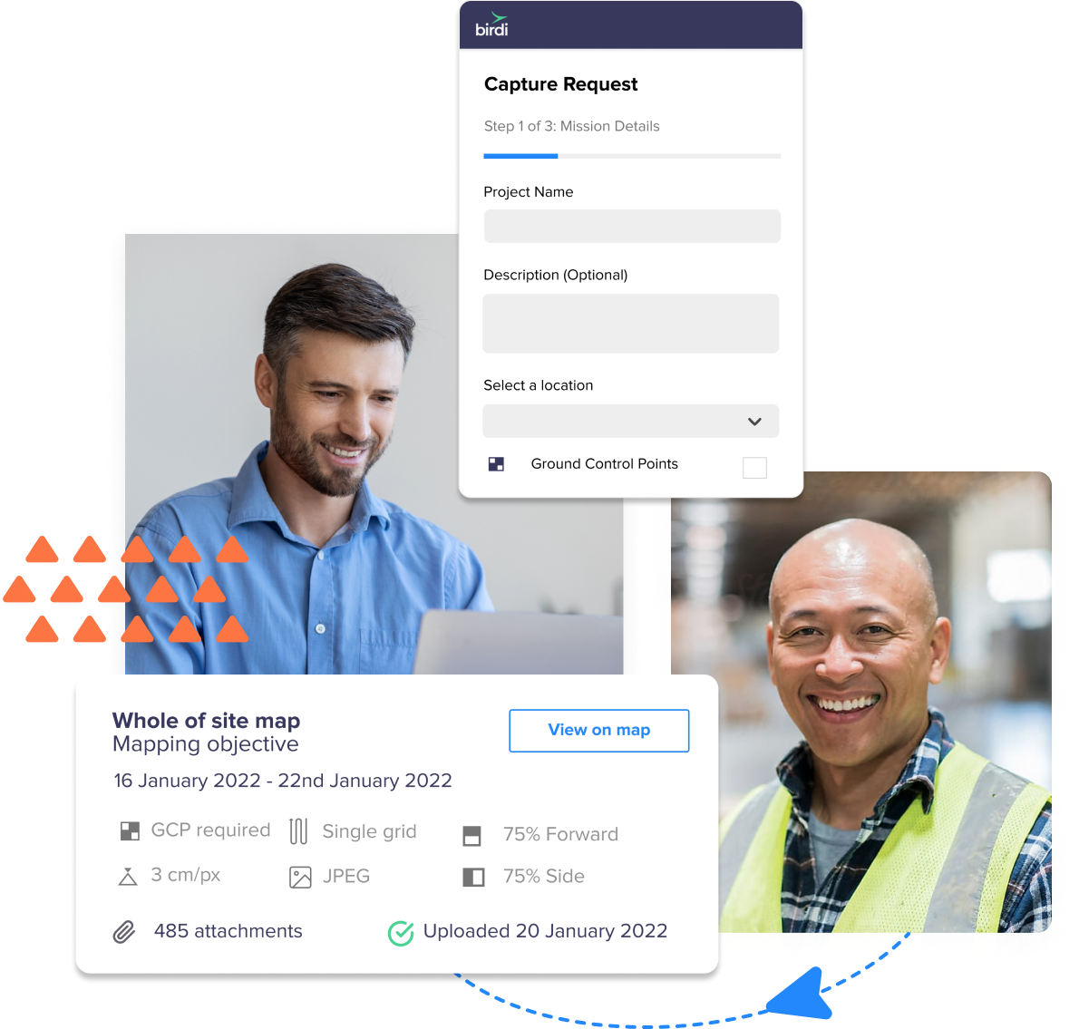
Easy drone data capture
Fly your own drones and upload
If you have your own in-house pilot to fly, capture your own data and upload it easily into the Birdi platform.
Birdi's pilot network
Our 2,000+ drone pilot network can complete missions for you across Australia. Available on our Enterprise plan.
.png)
Meaningful visualisations
View drone images directly on the map
Get a real view of where images were captured, with each image marked on the map for accurate visualisation.
Tools to draw and annotate
With our drawing tools, you can mark points of interest, identify areas, calculate surfaces, measure distances and more.
Data processing when you need it
Transform your data into a broad range of outputs
Such as:
- Orthophotos (.TIFF)
- Digital Elevation Models (DSM, DTM)
- Point Clouds (.LAS)
- Contours (.5m, 1m, 2m);
- 3D models and more
Turn on/off visual layers
In map view, get the insights you need by turning on and off the layers you want.
.png)
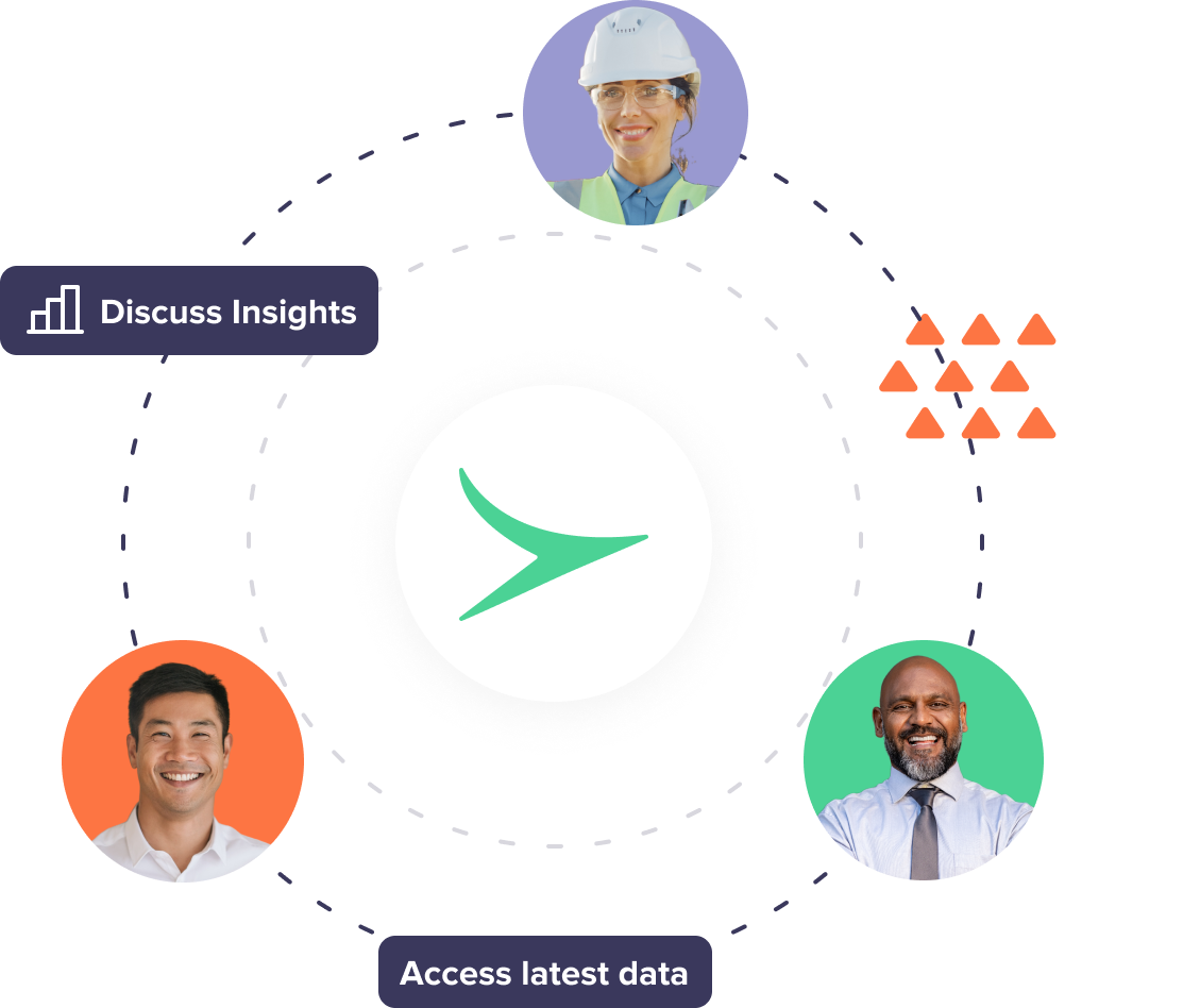
Accessible anywhere
Easily accessible by your team
All your missions and data are centralised within the Birdi platform, making it easy for your team to access the most up-to-date data.
Secure hosting
Birdi uses Amazon Web Services for secure, cloud-based hosting.
Need drone capture done for you?
Birdi can capture any site or asset, anywhere in Australia. Get site updates whenever you need: weekly, monthly, yearly - it’s up to you, compared to Nearmap’s manned aircraft imagery, which is captured periodically.
.gif)
Get started with Birdi
The best way to see if we're a good fit for your needs is through a no strings attached demo. Just 30 mins for us to wow you and show how we're different to Nearmap.